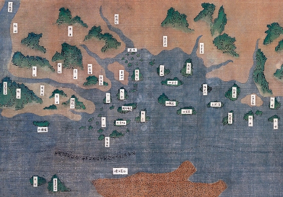
| Running from tomorrow (February 22) until May 15 at the Hong Kong Museum of History, "Sailing West: Admiral Zheng He's Voyages" exhibition features more than 60 precious artefacts and 100 photographs associated with Zheng He's voyages, reviewing the most remarkable chapter in China's maritime history. Pictured shows one of the exhibits, a replica larger than the original of "Zheng He's Navigation Map". The original map is lost and a sketch version is featured in "Wubeizhi" (Treaties on Armament Technology). It bears the names of countries, sea routes, directions, compass points and star positions. The geographical details and sea routes match those of Zheng's seventh voyage. The map is the oldest Chinese map in existence that features the continents of Asia and Africa. Hong Kong and its surrounding areas can be located on this map. "Fat Tong Mun" is the name of a place which is still in use today. "Guanfuzhai" is believed that it refers to Kowloon Peninsula whereas "Putaishan" is today's Po Toi Island. "Daxishan" on the map refers to Lantau Island or Hong Kong Island. |